Google Maps is going to introduce a new “Immersive View for Routes” feature in select cities, Google announced at its annual I/O conference today. The new feature brings all of the information that a user may need into one place, including details about traffic simulations, bike lanes, complex intersections, parking and more.
Immersive View for Routes will start to roll out in the coming months in 15 cities, including Amsterdam, Berlin, Dublin, Florence, Las Vegas, London, Los Angeles, Miami, New York, Paris, San Francisco, Seattle Tokyo and Venice. The feature will roll out on both Android and iOS. You can use the feature whether you’re driving, walking or cycling to your destination.
The new feature builds on Immersive View, which Google first announced at I/O last year, and is designed to help you plan ahead and get a deeper understanding of a city before you visit it. Immersive View uses computer vision and AI to fuse billions of Street View and aerial images together to create a digital model of the world. Immersive View for Routes follows the same concept, as it lets you preview and understand a route before you take it.
With Immersive View for Routes, you can see all the information you need about your route at once. When you get directions, you’ll see a multidimensional experience that lets you preview bike lanes, sidewalks, intersections and parking along your journey.
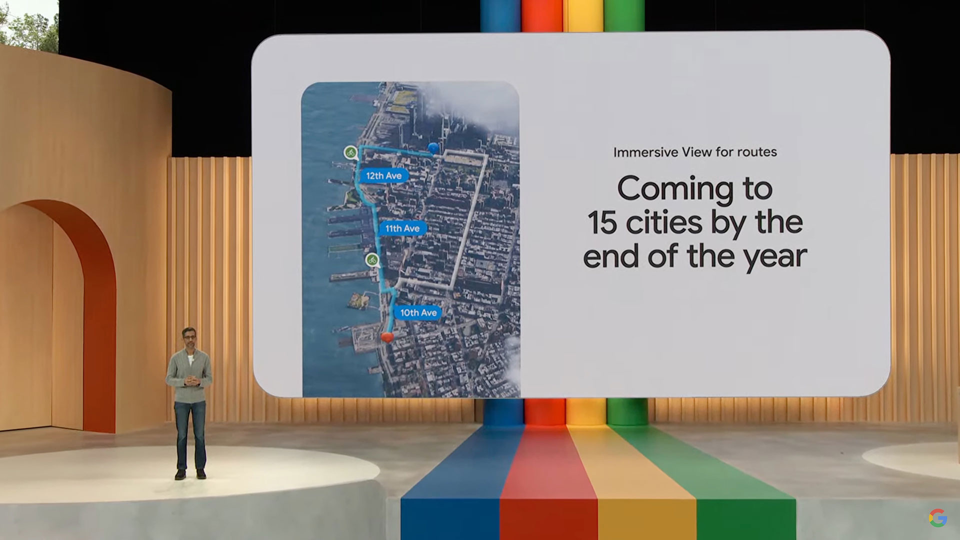
Image Credits: Google
The feature lets you see what the weather may look like on a specific day, or what traffic may look like at a certain time based on current and historical data that Google has gathered about a specific area. It includes a time slider that lets you see air quality information and how the route looks as the weather changes throughout the day.
“Google Maps provides 20 billion kilometers of directions every day,” Google CEO Sundar Pichai said during the company’s keynote. “That’s a lot of trips. Imagine if you could see your whole trip in advance. With Immersive View for Routes, now you can, whether you’re walking, cycling, or driving.”
Google also announced that it’s launching an Aerial View API for developers that lets them include a pre-packaged, birds-eye video of an area into their apps and websites to show what a place looks like in a visual way. One of Google’s early partnerships is with real estate company Rent.com, which is using the API to help renters visualize a property and its surrounding areas so they can explore a neighborhood virtually.
In addition, Google is launching an experimental release of Photorealistic 3D titles for developers. The new capability within the Google Maps Platform allows developers to easily create customized, immersive map experiences and visualizations that are unique to their brand. For example, a tourism company can develop an interactive map tour of architectural landmarks overlaying markers to share information about restaurants.
Google Maps is getting a new ‘Immersive View for Routes’ feature by Aisha Malik originally published on TechCrunch






 English (US) ·